Story in Brief
 |
 |
 |
 |
 |
 |
 |
 |
|
Wingecarribee Wetland - Location
Wingecarribee Swamp lies in the headwaters of the Wingecarribee River, which flows into the Wollondilly River and thence the Hawkesbury-Nepean River.
|
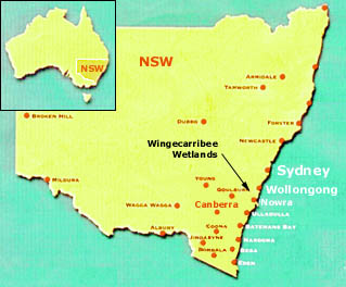 Wingecarribee
Swamp lies along a narrow valley running E-W between Robertson and
Moss Vale, in the Southern Highlands of NSW. It is approximately
13 km east of Moss Vale and 3km west of Robertson, the nearest substantial
town.
Wingecarribee
Swamp lies along a narrow valley running E-W between Robertson and
Moss Vale, in the Southern Highlands of NSW. It is approximately
13 km east of Moss Vale and 3km west of Robertson, the nearest substantial
town.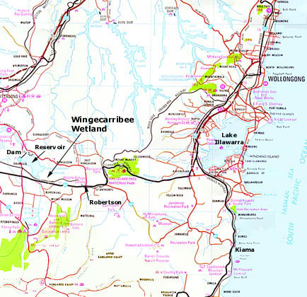
Home | Story in Brief | About Peatlands | Value of Swamp | History of the Swamp
Mining Impacts | Role of Government | Collapse of the Swamp
References | Glossary | Site Map | Credits/Contacts
http://www.herinst.org/wingecarribee/